Township History
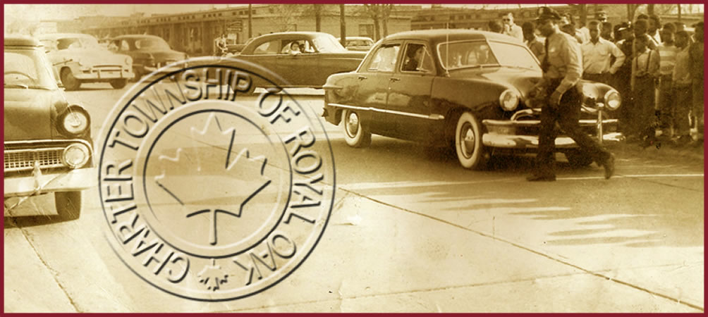
The history of the Charter Township of Royal Oak parallels the development of Detroit and Oakland County. As the economy of the area changed from an agricultural base in the 1800’s and early 1900’s, to one dependent of the transportation industry (railroads, carriages, streetcars, trolleys and support industries), so also changed the economy of Royal Oak Township.
With the launching of the auto industry in Detroit in 1903, the scene began to change even though at that time, nearly 80% of Oakland County was still being used for farming. The economy saw the greatest fluctuations with the occurrence and aftermath of World War I and World War II. It was thereafter that the economic situation made a dramatic change to an industrial base, which in turn was followed by a period of severe depression. The citizens of Royal Oak Township played an active part in the war production, but also suffered tremendous hardship during this period.
Royal Oak Township was originally a 36-mile section of Oakland County, but gradually diminished in size between 1921 and 1950 as cities broke off and became incorporated. What remains today of the Charter Township of Royal Oak is 0.7 square miles composed of town non-adjacent portions of land know as the 8-Mile section and the 10-Mile section. The former is an area of predominately African-American families, and the latter was primarily Jewish families.
The 8-Mile segment of the Township is imprinted with the social history of the country. It reflects the social status and the physical segregation of African-Americans throughout the country’s history. Families in advance of Detroit’s outward growth settled the Eight Mile area. Its initial development represented a hopeful “leapfrog” movement of African-American families from the inner city to outlying areas beyond the normal growth are of Detroit.
African-American families had settled in Detroit prior to 1763, when the British took possession of the city and found them in residence. Aided by the Underground Railroad, which used Detroit because of its proximity to Canada as a dispersal point, growth of the African-American population was fairly rapid. By 1860, the African-American population in Detroit had grown to 1,403 people, with a few of such families settling on scattered farm locations throughout the region. These farmland holdings later were sold to white families, with the exception of an area spanning Eight Mile, centered around Wyoming Road.
The Eight Mile segment is now a distinguished African-American residential community developed at an intimate, low-density scale. Residents of this segment can and do relate easily to this community. The area is an African-American enclave, which reflects both its historical origins and more recent urban renewal efforts.
The 10-Mile segment was part of more diffuse higher-density area occupied almost exclusively by elderly and middle-income white families.
Because of the effectiveness of restrictive covenants and other discriminatory practices, African-Americans seeking less dense areas were constrained from relocating to the immediate surrounding areas of city, as then defined. The Wyoming/Eight Mile Road area was a feasible and desirable option for African-American families seeking an escape from crowded areas of the City.
The African-American population within the City increased dramatically in three different waves before World War I, with industrial expansion following both World Wars. Coming from the rural south, many African-American families seeking escape were attracted to the Eight Mile area because of their desire to replicate an open rural environment, which they had left. Many of the homes were built with sweat equity on a payday-to-payday basis, resulting in what might have been described as a “shack town.” Many homes were constructed of makeshift materials. Around 1925, the portion of this area lying south of Eight Mile Road was annexed by the City of Detroit and became subject to the housing and building controls enforced by the City. The area north of 8 mile within the Township, subsequently felt the housing pressures exerted on African-American families seeking other residential options than those offered by the City of Detroit.
With the need for emergency housing during World War II, the federal government for temporary wartime housing acquired much of the available land in this part of Royal Oak Township.
The dramatic increase in population created burdens for the Township including burdens on the existing housing stock. Because of the war effort, many of the homes were overused with families doubling up. Garages, sheds and attics were also pressed into use as housing. In 1944, the population of this segment of the Township was only 2,989 persons. Temporary housing added 1,464 families by 1945 or an increase of 5,500 persons. In 1950, the population rose to 10,508 and a special census in 1956 indicated a population of 11,000, which appeared to be the saturation point for the one-half square mile area. By 1959, 1,708 or 75 percent of the approximately 2,300 units in the Township were adjudged dilapidated.
Beginning in the 1940’s while the Township was feeling the deterioration pressures, the surrounding areas were being built up by an affluent white population whose exodus from the City of Detroit had grown to the Township’s border. The African-American segment of Royal Oak Township thereby effectively became an isolated and deteriorated community in the midst of an affluent white area.
Taking advantage of the Housing Act of 1954, the Township, in 1959, finally approved an urban renewal project covering most of the Eight Mile Segment. The project area encompassed all of the area east and west of Wyoming, north of the north end, plus a couple of adjacent blocks. Activities were carried out over a 16-year period in accordance with the officially adopted urban renewal plan. The project (which had been officially amended for the seventh time by 1972) was terminated under “close-out procedures”, as a federally supported urban renewal project as of 1975. Project activities remaining to be completed now fall to the Township’s community development department.
After the annexation of the north end of the Township to the City of Oak Park, the current population is approximately 2,840 people.